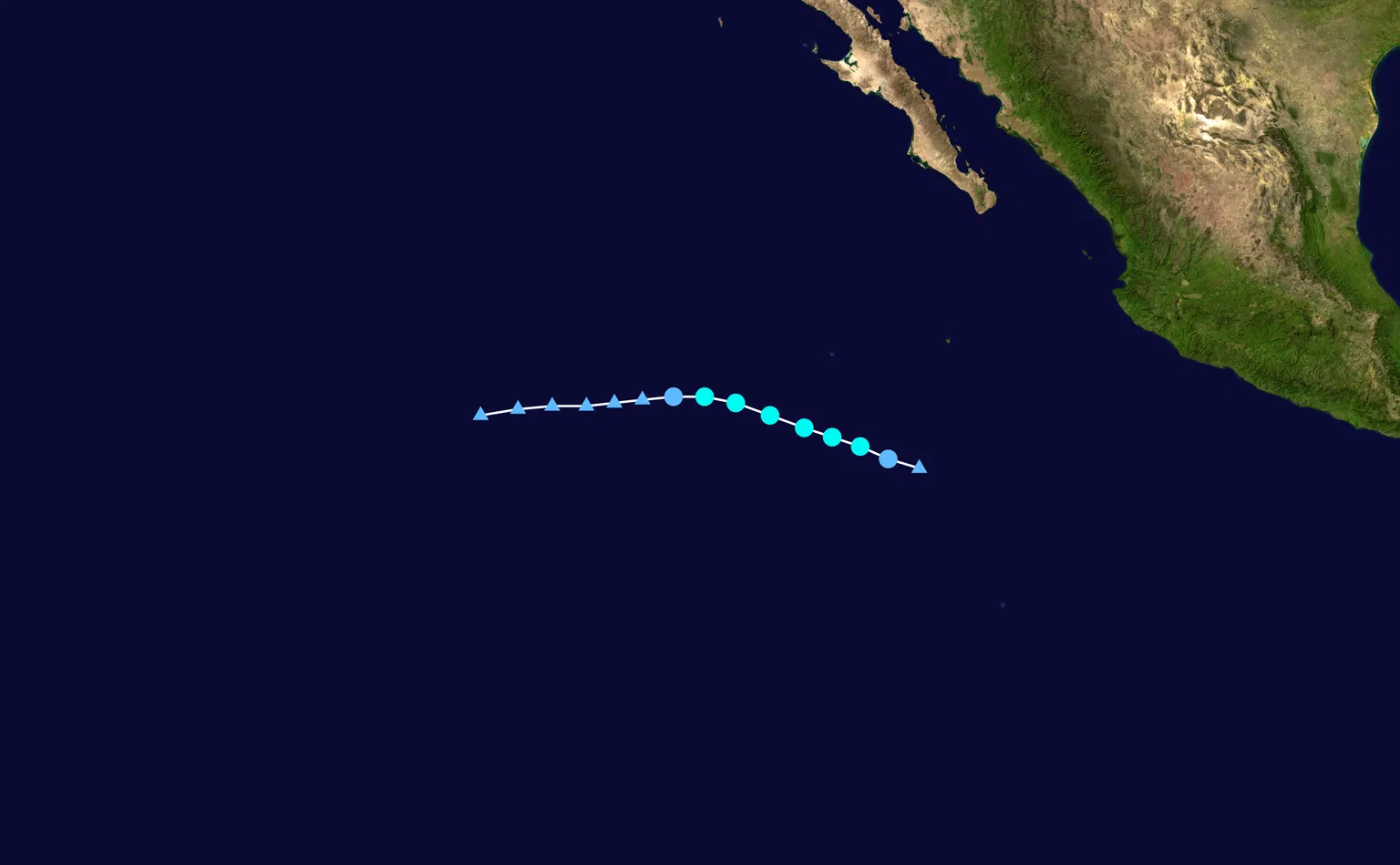
Hurricane Polo churned across the eastern Pacific Ocean, drawing attention to Mexico's coastline and to one of the most powerful forces in nature. But what exactly is Hurricane Polo, how do hurricanes like it form, and what can coastal residents and travelers do to prepare before the next storm arrives? This guide breaks down the science, the categories, and the safety steps in plain language.
What Is Hurricane Polo?
"Polo" is a name on the rotating list used for eastern Pacific tropical cyclones, and the name has been assigned to more than one storm over the years. The two most significant storms to carry the name were Hurricane Polo in 2014 and Hurricane Polo in 2020.
In 2014, Hurricane Polo formed in September—near the peak of the eastern Pacific season—and strengthened into a Category 1 hurricane while tracking close to Mexico's southwestern coast. The storm's outer bands brought heavy rainfall to coastal states including Colima and Jalisco, leading to localized flooding, mudslides, and dangerous surf along the shoreline.
The 2020 Hurricane Polo was notable mainly for its timing. It developed in mid-November, unusually late in a season that officially runs from May 15 through November 30. Also a Category 1 hurricane, the 2020 storm spun over open water south of the Baja California peninsula. Because its center stayed offshore, it did not make a direct landfall—but it served as a reminder that late-season storms remain possible even as the calendar turns toward winter.
How Hurricanes Like Polo Form
Hurricanes are a type of tropical cyclone—rotating, organized storm systems that draw their energy from warm ocean water. In the Atlantic and eastern Pacific they are called hurricanes; the same phenomenon is called a typhoon in the western Pacific and a cyclone in the Indian Ocean. In Spanish-speaking regions, the word is "huracán," which is the origin of the English term.
For a hurricane to form, forecasters look for a handful of specific ingredients working together.
Warm water. The ocean surface generally needs to be at least 80 degrees Fahrenheit (about 26.5 degrees Celsius), warm to a depth of roughly 150 feet. This warmth drives evaporation, loading the air above with moisture and heat—the fuel a hurricane runs on.
A starting disturbance. Most eastern Pacific hurricanes, including Polo, begin as a tropical wave or a cluster of thunderstorms. This disturbance provides the initial spin and lift that can grow into something much larger.
Low wind shear. Wind shear is the change in wind speed or direction with altitude. When shear is strong, it can tear a developing storm apart. Low shear lets the thunderstorms stack and build into a single organized system.
Distance from the equator. Earth's rotation produces the Coriolis force, which gives a hurricane its characteristic spin. Too close to the equator—within about 5 degrees of latitude—there isn't enough rotation to get a storm going.
When these conditions align, a system moves through a defined life cycle. It starts as a tropical disturbance, becomes a tropical depression as winds organize, and is named a tropical storm once sustained winds reach 39 mph. It earns the title of hurricane only when sustained winds hit at least 74 mph (119 km/h). Mature hurricanes develop an eye—a calm, clear center—surrounded by the eyewall, the ring of strongest winds and heaviest rain, with spiral rainbands extending outward for hundreds of miles.
The eastern Pacific, where Polo formed, is one of the most active hurricane basins on the planet. Warm water off Mexico and Central America, combined with a steady supply of tropical waves, produces an average of about 15 named storms each season. Storms that form there often track parallel to Mexico's coast or drift west into the open ocean, but some curve toward land and bring heavy rain, flooding, and storm surge.
How Forecasters Rate Hurricanes: The Saffir-Simpson Scale
Once a storm reaches hurricane strength, meteorologists communicate its power using the Saffir-Simpson Hurricane Wind Scale, which divides hurricanes into five categories based on maximum sustained wind speed.
- Category 1: 74–95 mph — very dangerous winds; roof, shingle, and power line damage. (Both the 2014 and 2020 Hurricane Polo reached this level.)
- Category 2: 96–110 mph — extremely dangerous winds; major roof and siding damage; near-total power loss possible.
- Category 3: 111–129 mph — devastating damage; well-built homes may lose roofs and exterior walls.
- Category 4: 130–156 mph — catastrophic damage; most trees snapped or uprooted; many homes destroyed.
- Category 5: 157 mph or higher — catastrophic damage; a high percentage of framed homes destroyed and areas left uninhabitable for weeks or months.
Storms that reach Category 3 or above are labeled "major" hurricanes. One crucial caveat: the scale measures wind only. It does not account for storm surge, rainfall, or inland flooding, which are frequently the deadliest aspects of a hurricane. A slow-moving Category 1 storm can produce catastrophic flooding, so a storm's danger should never be judged by its category alone.
How Hurricanes Get Their Names
Why "Polo"? The World Meteorological Organization maintains six rotating lists of names for Atlantic and eastern Pacific storms. Names are short, distinctive, and easy to remember, and they alternate between male and female in alphabetical order. When a storm is especially deadly or costly, its name is retired—think Hurricane Katrina or Hurricane Otis—and replaced with a new name. Polo has not been retired, so it continues to appear on the eastern Pacific list and could be used again in a future season.
How to Prepare for a Hurricane
Preparation is the difference between riding out a storm safely and facing avoidable risk. Emergency managers recommend taking these steps well before a hurricane appears in the forecast.
Know your zone and your route. Determine whether you live in an evacuation zone and learn the recommended route to higher ground. Decide in advance where you would go and how you would get there if officials issue an evacuation order.
Build an emergency kit. Stock at least one gallon of water per person per day for a minimum of three days, plus non-perishable food, a flashlight, extra batteries, a first-aid kit, needed medications, and copies of important documents. Add cash, chargers, and a battery-powered or hand-crank radio so you can receive updates if the power fails.
Secure your home. Bring in or tie down outdoor furniture and loose items, trim trees and shrubs, and install storm shutters or board up windows. Move valuables and electronics away from windows and, where possible, to higher floors to reduce flood risk.
Stay informed. Follow official sources such as the National Hurricane Center in the United States or Mexico's national meteorological service (SMN) for forecasts, watches, and warnings, and act on guidance from local officials without delay.
Protect yourself during the storm. Stay indoors and away from windows. Never walk or drive through floodwater—just six inches of moving water can knock an adult down, and a foot of water can sweep away a vehicle.
The Bottom Line: What to Remember About Hurricane Polo
- Hurricane Polo is an eastern Pacific storm name used across multiple seasons, with notable Category 1 hurricanes in 2014 and 2020.
- Hurricanes form over warm ocean water when moisture, low wind shear, and Earth's rotation allow thunderstorms to organize into a rotating system.
- The Saffir-Simpson scale rates hurricanes from Category 1 to 5 by sustained wind speed; Category 3 and above are "major" hurricanes.
- Wind speed is not the only danger—storm surge, rainfall, and flooding are often the deadliest threats.
- Preparation—knowing your evacuation zone, building an emergency kit, securing your home, and following official alerts—is the best protection.