

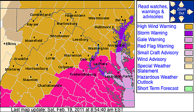
As Hawaii residents brace for another day of dangerous weather, a High Wind Warning remains in effect across the islands with gusts expected to reach 60 miles per hour or higher. This urgent alert from the National Weather Service highlights a critical safety threat that many Americans may encounter, but few fully understand. High wind warnings represent one of the most serious weather alerts issued by meteorologists, signaling conditions that can topple trees, damage homes, and create life-threatening situations within minutes. Understanding what these warnings mean, how they differ from other wind alerts, and what actions to take could literally save your life when severe weather strikes.
Breaking Down Wind Alerts: Warning vs. Watch vs. Advisory
The National Weather Service uses a specific hierarchy of wind-related alerts to communicate danger levels to the public. According to the NWS safety guidelines, a High Wind Warning is the most urgent alert, issued when "sustained, strong winds with even stronger gusts are happening." This means dangerous wind conditions are already occurring or will begin shortly, requiring immediate protective action. The warning triggers when sustained winds reach 40 miles per hour or higher for at least one hour, or when wind gusts hit 58 miles per hour or greater.
One step down in severity is the High Wind Watch, which indicates that sustained strong winds are possible in the coming 12 to 48 hours. This watch status means conditions are favorable for dangerous winds to develop, giving people time to prepare by securing outdoor items and reviewing safety plans. As the NWS emphasizes, a watch means "be prepared" rather than "take action."
The Wind Advisory represents the lowest level of wind alert, issued when strong winds are occurring but don't reach high wind warning criteria. While still requiring caution—particularly for drivers and those with outdoor activities—wind advisories typically involve sustained winds of 30-39 mph or frequent gusts between 45-57 mph. The key distinction, as explained by weather officials, is that wind advisories warrant securing loose objects and exercising care, while high wind warnings demand seeking shelter and avoiding travel.
How Meteorologists Decide to Issue High Wind Warnings
The process of issuing a high wind warning involves sophisticated weather monitoring and strict criteria. National Weather Service offices across the country use a combination of weather stations, radar data, computer models, and observational reports to detect developing wind threats. When forecast models predict sustained winds of 40+ mph or gusts of 58+ mph, meteorologists analyze the timing, duration, and geographic scope of the event.
Local NWS offices have some flexibility in adjusting criteria based on regional factors—coastal areas might have different thresholds than mountainous regions—but the 40/58 mph standard serves as the national baseline. Warning decisions also consider potential impacts: winds of this magnitude can snap tree limbs, knock down power lines, send unsecured objects airborne, and make driving hazardous, especially for high-profile vehicles.
The warning issuance process follows a precise timeline. First, forecasters identify the potential threat 1-3 days in advance, sometimes issuing a High Wind Watch. As confidence increases and the event approaches, the watch may be upgraded to a warning, typically 6-12 hours before the strongest winds arrive. This graduated alert system gives emergency managers, utility companies, and the public crucial lead time to prepare.
More Than Just Breezy: The Hidden Dangers of High Winds
High winds pose multiple threats that extend beyond simple inconvenience. According to safety experts, the primary dangers include falling trees and branches, which account for numerous injuries and fatalities during wind events. A mature tree can weigh several tons, and when combined with saturated ground from rain—as often accompanies wind storms—the risk of uprooting increases dramatically.
Power outages represent another major concern. Winds knocking trees into power lines can leave thousands without electricity, sometimes for days. This creates cascading risks: no power means no sump pumps during flooding, no medical equipment for those who depend on it, and no heating or cooling during temperature extremes.
Perhaps the most underestimated danger involves wind-borne debris. At 40 mph, unsecured patio furniture, garbage cans, gardening tools, and construction materials become dangerous projectiles. These objects can break windows, damage vehicles, and cause serious injury. The NWS specifically warns drivers to keep both hands on the wheel during high wind events, as sudden gusts can make vehicles difficult to control, especially on bridges, overpasses, and open highways.
Real-Time Example: Hawaii's High Wind Emergency
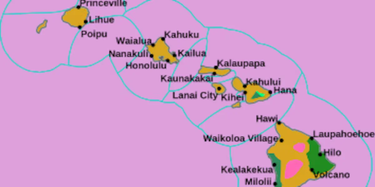
The urgency of high wind warnings became vividly apparent in February 2026 when the National Weather Service in Honolulu issued a widespread High Wind Warning for all Hawaiian Islands. Forecasters predicted northeast winds of 25-40 mph with gusts up to 60 mph or higher, lasting through multiple days. The warning cited specific threats: "Strong wind gusts could reach 60 miles per hour and above throughout Monday," creating conditions capable of causing "power outages, property damage, and difficult travel."
This event demonstrated the compounding nature of weather threats—the high winds coincided with heavy rainfall and flood watches, creating multiple overlapping hazards. Hawaii officials took the warning seriously, closing all University of Hawaii campuses and urging residents to secure outdoor items, charge emergency devices, and avoid unnecessary travel. The situation showed how high wind warnings trigger coordinated responses from government agencies, utilities, and emergency services.
Meteorologists noted that the Hawaii event resulted from a strong pressure gradient between a high-pressure system to the north and a low-pressure system to the south—a classic setup for sustained high winds. Such patterns can affect various regions across the United States, particularly during seasonal transitions when temperature differences create stronger pressure gradients.
Preparing Before the Wind Hits: Your Action Plan
Preparation separates those who weather high wind events safely from those who face preventable damage. The National Weather Service's "Before a High Wind Event" guidelines offer a comprehensive checklist. First, trim tree branches away from your house and power lines—this simple maintenance can prevent most wind-related property damage. Next, secure loose gutters and shutters; these are often the first components to detach during storms.
Perhaps the most critical step: identify an interior room—such as a basement, storm cellar, or interior bathroom—where you can take shelter when warnings are issued. For those in mobile homes, identifying a sturdy building to relocate to is essential, as manufactured homes are particularly vulnerable to wind damage.
Emergency kit preparation takes on added importance during wind events. The NWS recommends charging all essential devices—cell phones, weather radios, power tools like reciprocating saws for debris clearance—before winds arrive. Update your emergency supplies to include enough food and water for three days per person, plus batteries, flashlights, and first aid materials.
Finally, create a wind-specific checklist of outdoor items that need securing: patio furniture, grills, trash cans, gardening equipment, decorations, and children's toys. When a high wind watch is issued, immediately secure these items—don't wait for the warning, as winds can intensify rapidly.
When the Warning Sounds: Immediate Safety Actions
Once a High Wind Warning is issued for your area, immediate action is required. First, seek shelter in your designated interior room, away from windows. If you're driving, the NWS instructs to "keep both hands on the wheels and slow down." Consider pulling over at the nearest safe location if winds become severe.
If you're outdoors, avoid areas with trees—the "lean-to" effect near buildings can create dangerous wind tunnels. Never approach downed power lines; assume they're live and report them immediately to utility companies. Stay informed through NOAA Weather Radio, trusted weather apps, or local news for updates on the warning status.
During the event, monitor for changing conditions. High winds can quickly escalate, bringing down trees or power lines with little warning. If you hear creaking or snapping sounds from trees, move to a more secure location. Keep emergency supplies handy, including a battery-powered radio for updates if power fails.
After the Storm: Safe Recovery Procedures
When the High Wind Warning expires, caution remains essential. Before venturing outside, survey your property from a safe distance. Look for downed power lines, damaged trees, and structural issues. Wear sturdy shoes and gloves when clearing debris, and be alert for nails, glass, or other sharp objects.
Document any damage with photographs for insurance claims, but avoid making permanent repairs until professionals assess the situation. If you use a generator, operate it only outdoors and away from windows to prevent carbon monoxide poisoning—a common post-storm danger.
Check on neighbors, especially elderly or disabled individuals who may need assistance. Report ongoing hazards like blocked roads or dangling tree limbs to local authorities. Remember that aftershocks of high wind events—such as weakened tree roots or compromised structures—can pose dangers for days afterward.
The Bottom Line: Essential High Wind Warning Knowledge
High wind warnings represent serious weather emergencies that demand respect and preparation. Remember these crucial points: A High Wind Warning means dangerous winds are happening now—seek immediate shelter. A High Wind Watch means conditions are favorable—prepare your property. A Wind Advisory means exercise caution—secure loose items.
The 40/58 mph criteria (sustained/gust) serves as the national standard for high wind warnings. Preparation includes trimming trees, securing outdoor items, identifying shelter, and maintaining emergency supplies. During an event, stay indoors, avoid windows, and keep informed. Afterward, proceed cautiously with recovery efforts.
With climate patterns potentially increasing the frequency and intensity of wind events, understanding high wind warnings has never been more important. This knowledge transforms you from a vulnerable observer to an informed participant in your own safety—ready to respond appropriately when the next warning sounds.