

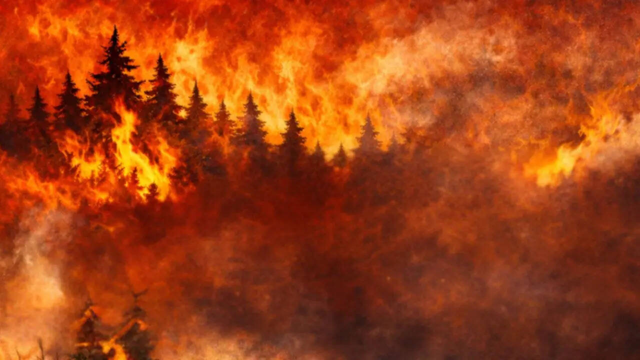
When the National Weather Service issues a fire weather watch, it's signaling that dangerous conditions are developing that could lead to rapidly spreading wildfires. These alerts have been popping up across the United States recently, from the plains of Iowa to the panhandle of Florida, as dry vegetation combines with gusty winds and low humidity to create perfect storm conditions for fire danger. Understanding what these watches mean, how they work, and what you should do when one is issued can be the difference between safety and catastrophe.
Recent Fire Weather Alerts Across Multiple States
This weekend, dangerous fire conditions are brewing across multiple states, with the National Weather Service putting large swaths of Iowa, Alabama, and the Kansas City region on alert. In southwest and central Iowa, a red flag warning covers 19 counties including Polk, Dallas, Warren, Madison, Decatur, and Wayne, running from noon to 9 p.m. CDT on Friday. The NWS office in Des Moines warned that northwest winds of 10 to 15 mph with gusts reaching 30 mph will combine with humidity levels dropping to between 20 and 25 percent, creating conditions where any fire that starts will move rapidly.
Meanwhile, north Alabama faces a separate fire weather watch for a dozen counties including Madison, Limestone, Lauderdale, Jackson, DeKalb, and Cullman from 7 a.m. to 7 p.m. Saturday. The Kansas City metro and surrounding counties are also under a fire weather watch covering both Kansas and Missouri, including Leavenworth, Wyandotte, Johnson, Platte, Clay, and Jackson counties through Saturday evening. These widespread alerts highlight how fire weather conditions can develop across different regions simultaneously when atmospheric patterns align.
The Critical Difference: Fire Weather Watch vs. Red Flag Warning
Understanding the distinction between a fire weather watch and a red flag warning is essential for proper preparation and response. According to the National Weather Service, a fire weather watch means "BE PREPARED" – critical fire weather conditions are expected or possible, but not imminent or occurring. Think of it as a heads-up that dangerous conditions could develop in the next 12 to 72 hours. It's a signal to land managers, firefighters, and the public to get ready and stay informed.
A red flag warning, on the other hand, means "TAKE ACTION." This is the more serious alert, indicating that critical fire weather conditions are either already happening or are expected to occur shortly. When a red flag warning is issued, the dangerous combination of dry fuels, low humidity, and strong winds is either present or imminent, creating conditions where fires can ignite easily and spread rapidly.
The Science Behind Fire Weather Criteria
Fire weather watches aren't issued arbitrarily – they follow specific meteorological criteria developed by the National Weather Service. The primary conditions that trigger these alerts include relative humidity of 15% or less combined with sustained surface winds, or frequent gusts, of 25 mph or greater. Both conditions must occur simultaneously for a watch or warning to be issued. This combination is particularly dangerous because low humidity dries out vegetation (creating abundant fuel) while strong winds provide the oxygen and spreading mechanism for fires.
Additional factors considered include dry thunderstorms (15% coverage or greater), very dry fuels as indicated by fuel moisture measurements, and the Keetch-Byram Drought Index (KBDI) readings above 600 in some regions. The NWS issues fire weather watches when there's reasonable confidence that red flag conditions may occur in the near future, typically 12 to 48 hours ahead of the expected event. This advance warning gives emergency personnel and the public time to prepare.
Why Florida's Panhandle Recently Faced Fire Weather Watches
The Florida panhandle experienced a fire weather watch recently due to a combination of dry air and gusty northeasterly winds. These conditions created an elevated risk for fires to start and spread quickly across the region's unique vegetation. Florida's fire weather dynamics differ from western states – the state's frequent lightning strikes combined with dry conditions can create particularly dangerous situations. When the National Weather Service in Jacksonville issues a fire weather watch for the region, it's alerting residents that any outdoor burning could quickly get out of control and that extra precautions are necessary.
Essential Safety Measures During Fire Weather Watches
When a fire weather watch is issued for your area, taking proactive steps can significantly reduce your risk. First and foremost, stay informed by monitoring updates from your local fire department and emergency management offices. Keep track of air quality reports as well – smoke from nearby fires can affect visibility and cause breathing problems even before flames reach your area.
Protecting your property is crucial during fire weather watches. Water your lawn, shrubs, and trees if possible to increase moisture content. Clear dry leaves, brush, and other flammable debris from around your home, creating defensible space. Move firewood, propane tanks, and grills away from any structures. Having a go-bag ready with essential items including water, non-perishable food, medications, flashlight, batteries, first-aid kit, and copies of important documents can save precious time if evacuation becomes necessary.
Perhaps most importantly, avoid any activities that could spark a fire. This means no burning of trash or brush, no open flames, and extra caution with cigarettes and matches outdoors. If you're driving through dry grass or brush areas, be aware that dragging metal parts or chains on a vehicle can throw sparks. Remember that under fire weather watch conditions, even a small spark can quickly grow into a major wildfire.
The Timeline of Fire Weather Development
Fire weather conditions typically develop over a predictable timeline that emergency managers monitor closely. The process often begins with an extended dry period that cures vegetation, followed by a weather pattern bringing strong winds and low humidity. Meteorologists watch for specific atmospheric setups, including approaching cold fronts, strong pressure gradients, or dry air masses moving into regions with abundant dry fuels.
When forecast models show these elements coming together with sufficient confidence, the National Weather Service issues a fire weather watch approximately 12 to 48 hours before the expected critical conditions. As the event draws closer and confidence increases, the watch may be upgraded to a red flag warning, typically within 24 hours of the conditions materializing. This graduated alert system allows for progressive preparation and response.
Regional Variations in Fire Weather Patterns
Fire weather conditions vary significantly across different regions of the United States, influenced by local vegetation, climate patterns, and topography. In western states, Santa Ana winds (Southern California) and Diablo winds (Northern California) create particularly dangerous fire weather conditions when they combine with dry vegetation. These katabatic winds flow from higher elevations down to coastal areas, warming and drying as they descend, often reaching hurricane-force speeds.
In the Plains states, strong winds ahead of cold fronts combined with dry air from the southwest create critical fire weather conditions across grasslands and agricultural areas. The Southeast experiences fire weather threats during dry periods, particularly in pine forests and areas with abundant undergrowth. Florida's fire season typically peaks in spring before summer rains begin, while western states face greatest risk during late summer and fall when vegetation is driest.
How Climate Change is Affecting Fire Weather Frequency
Research indicates that climate change is increasing the frequency and severity of fire weather conditions across many parts of the United States. Warmer temperatures lead to earlier snowmelt, longer dry seasons, and increased evaporation, all of which contribute to drier fuels. Studies show that the annual number of days with high fire weather potential has increased significantly in western states over recent decades, extending the fire season and creating more opportunities for catastrophic wildfires.
The National Weather Service and land management agencies are adapting their forecasting and warning systems to account for these changing patterns. This includes developing more sophisticated models that incorporate climate projections and updating fire weather criteria to reflect new realities. As fire weather patterns evolve, public education about these alerts becomes increasingly important for community safety.
What Happens After a Fire Weather Watch is Issued
Once a fire weather watch is issued, a coordinated response system swings into action. Land management agencies like the U.S. Forest Service, Bureau of Land Management, and state forestry departments increase their readiness levels, positioning firefighting resources strategically and implementing preventive measures. Local fire departments increase patrols in high-risk areas and may implement burning bans or restrictions.
Emergency managers use the watch period to communicate with vulnerable communities, particularly those in wildland-urban interface areas where homes border flammable vegetation. Utility companies may implement public safety power shutoffs in extreme conditions to prevent power lines from sparking fires. The watch period provides crucial time for所有这些协调工作 before conditions potentially escalate to red flag warning status.
Key Takeaways for Fire Weather Awareness
Understanding fire weather watches comes down to several essential points. First, recognize that a watch means conditions are possible – it's time to prepare, not panic. Second, know the difference between a watch (be prepared) and a warning (take action). Third, familiarize yourself with the specific risks in your region, whether you live in wildfire-prone areas or not. Fourth, have a plan that includes both property protection and evacuation readiness. Finally, stay informed through reliable sources like the National Weather Service and local emergency management agencies.
As fire weather patterns continue to evolve with changing climate conditions, these alerts will remain critical tools for protecting lives and property. By understanding how fire weather watches work, what triggers them, and how to respond appropriately, you can significantly increase your safety and resilience in the face of growing wildfire risks across the United States.