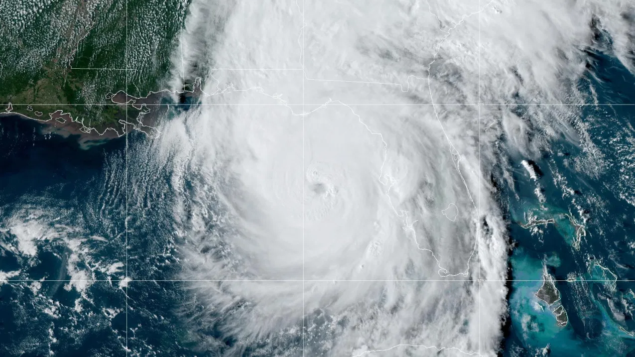
It sounds like a contradiction—Hawaii is famous for its gentle trade winds, not violent storms—but a "hawaii hurricane" is a real, if uncommon, threat. Hurricanes do form in the waters around the islands, and the same recipe that brews tropical storms and hurricanes anywhere on Earth is at work in the central Pacific every summer. In simple terms, a hurricane is a tropical cyclone: a rotating low-pressure system that feeds on warm, moist ocean air. To earn the "hurricane" label, a storm's maximum sustained winds must reach at least 74 mph. Below that threshold, it is a tropical storm (39–73 mph) or a tropical depression (under 39 mph). Hawaii's location puts it in the path of several named storms each season, yet direct hits remain surprisingly rare, because cooler water and wind shear often tear approaching storms apart. Here is how these storms form, what separates a hurricane from a tropical storm, and why Hawaii is both exposed and, in a sense, shielded.
How Hurricanes Form: Warm Water and the Earth's Spin
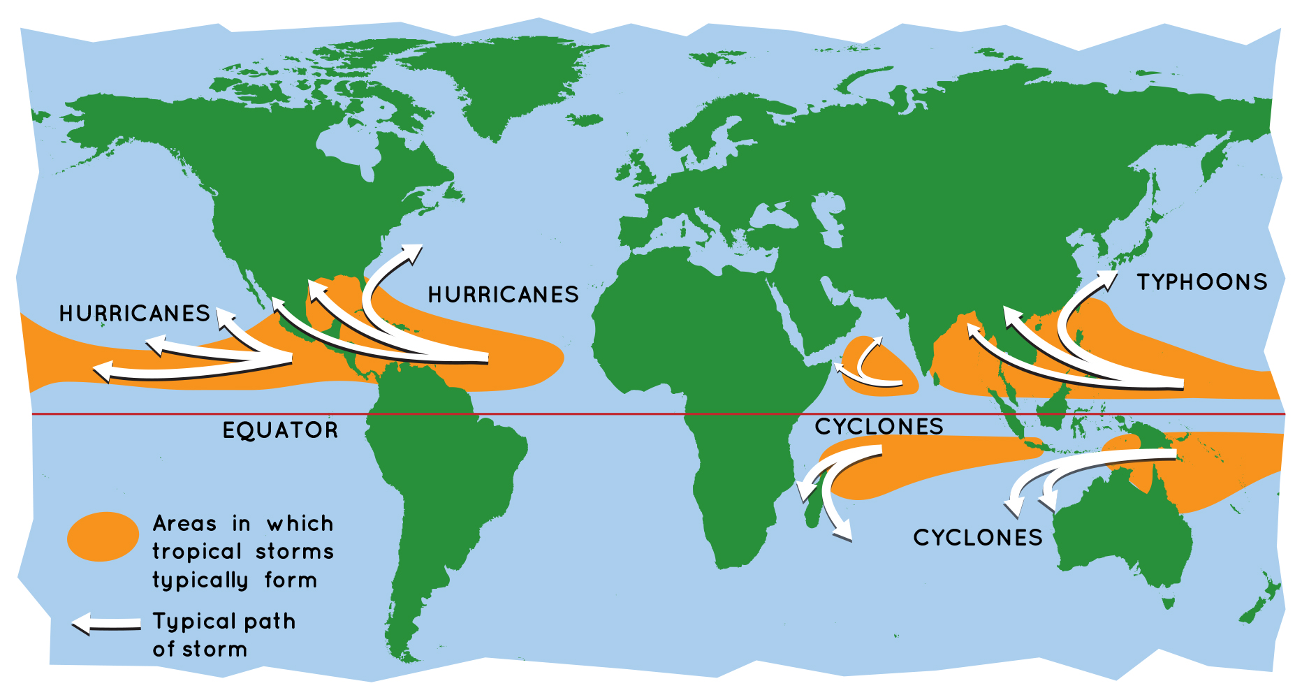
Every hurricane—whether called a hurricane, typhoon, or cyclone—begins the same way. The scientific name for all of these storms is "tropical cyclone," and NASA describes them as giant engines that use warm, moist air as fuel. That engine only starts over warm ocean water, generally at least 80°F (about 26.5°C), which is why these systems are born in the tropics near the equator.
The process is a chain reaction. The sun heats the ocean, and warm, moist air rises from the surface. As that air climbs, it leaves behind an area of lower air pressure below. Surrounding air, which sits at higher pressure, rushes in to fill the gap—then warms, picks up moisture, and rises too. As the rising air cools, its water vapor condenses into towering cumulonimbus clouds and releases heat, which powers the storm even more.
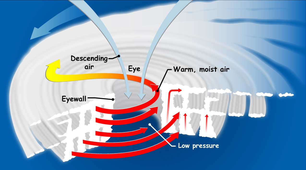
Earth's rotation gives the growing system its signature spin through the Coriolis effect. Storms north of the equator spin counterclockwise, while storms south of the equator spin clockwise. As the system rotates faster and faster, a calm, clear eye forms at the center with very low air pressure, ringed by a wall of intense thunderstorms called the eyewall.
From Tropical Wave to Category 5: Every Stage, Explained
Not every cluster of clouds becomes a hurricane. A storm climbs a precise ladder as its sustained winds strengthen, and each rung has a name and a number. NOAA defines a tropical depression as a tropical cyclone with maximum sustained winds under 39 mph. When those winds reach 39 mph, the system is upgraded to a tropical storm and receives a name—like Iniki, the Hawaiian word for "a sharp and piercing wind."
Only when maximum sustained winds hit 74 mph does a tropical storm become a hurricane. From there, the Saffir-Simpson Hurricane Wind Scale rates a hurricane from Category 1 to Category 5 based solely on wind speed. A Category 1 storm packs winds of 74–95 mph, while a Category 5 tops 157 mph. Hurricanes rated Category 3 or higher are considered "major hurricanes," capable of devastating to catastrophic wind damage.
This ladder matters because it drives warnings, evacuations, and preparation. The same system that drifts across the ocean as an unnamed depression can, given enough warm water and little wind shear, spin up into a named storm—and, in the right conditions, a major hurricane.
Tropical Storm vs. Hurricane: The 74 mph Line That Changes Everything
The difference between a tropical storm and a hurricane comes down to a single number: 74 mph. A tropical storm's winds range from 39 to 73 mph, while a hurricane's winds reach 74 mph or higher. The practical gap is enormous. A tropical storm can still deliver heavy rain, flooding, and dangerous surf, but a hurricane's winds are strong enough to peel roofs, snap power lines, and drive deadly storm surge ashore.
It is also worth noting what the wind scale does not measure. The Saffir-Simpson scale ignores storm surge, rainfall flooding, and tornadoes, all of which can be lethal even in a weaker storm. In Hawaii, where steep volcanic terrain funnels rain into flash floods and coastal neighborhoods sit close to sea level, a tropical storm or a glancing hurricane can still cause serious damage even without a direct landfall.
Why Hawaii Usually Gets Spared: Wind Shear and Cooler Water
Hawaii sits in the central North Pacific, a basin monitored by the Central Pacific Hurricane Center in Honolulu, which covers the region between 140°W longitude and the International Date Line. The official Pacific hurricane season runs from June 1 through November 30, though storms can and do form at other times of year.
Yet full-force hurricanes rarely strike the islands head-on, thanks to two natural defenses. First, sea surface temperatures around Hawaii are often only marginally warm—enough to sustain a storm but sometimes too cool to intensify one, since hurricanes need roughly 80°F water to thrive. Second, vertical wind shear, or changes in wind speed and direction with height, frequently disrupts the structure of approaching storms, tilting them and blowing their tops apart before they can strengthen. Storms that sweep in from the east or southeast also tend to weaken as they meet these conditions.
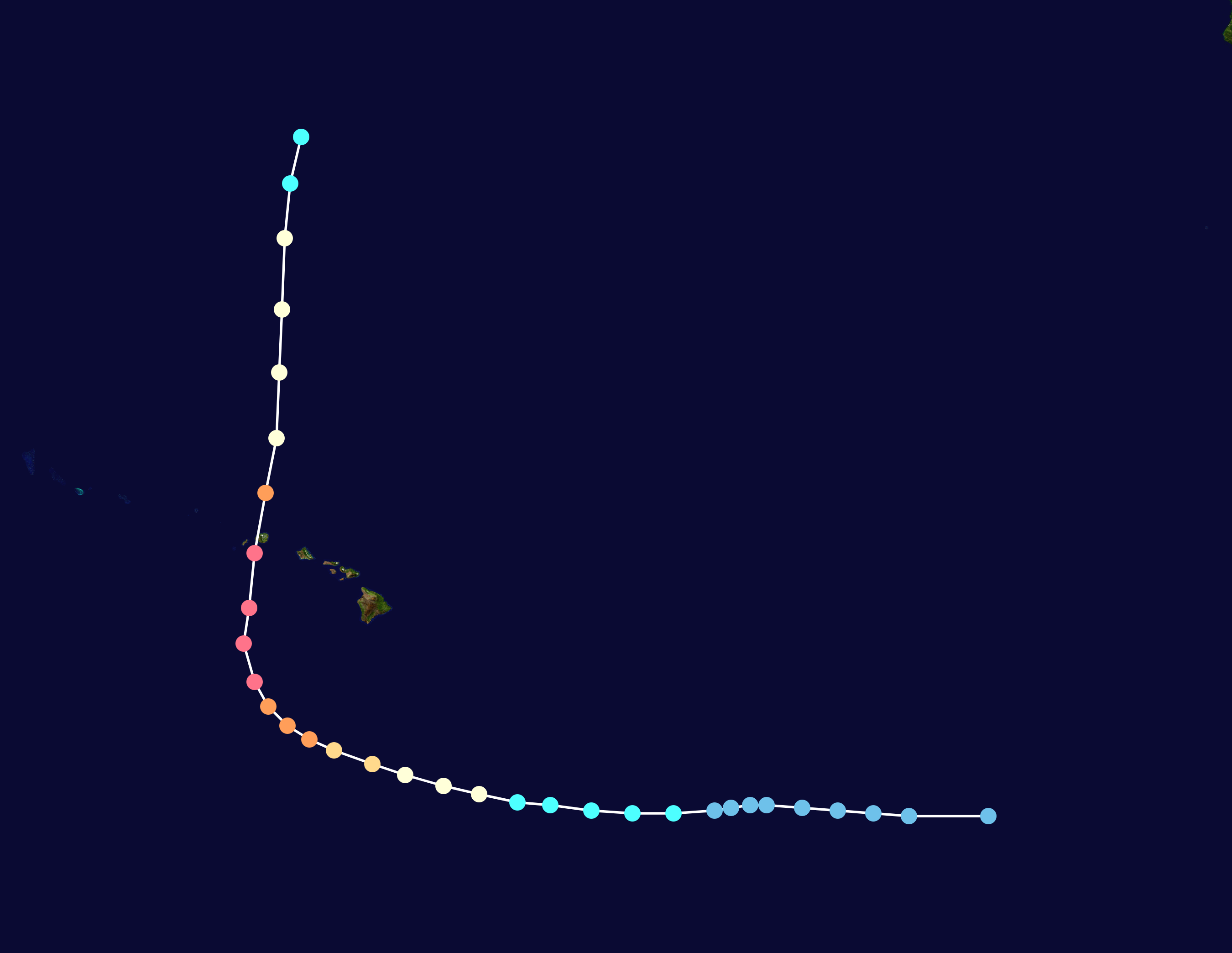
That does not mean the islands are immune. In September 1992, Hurricane Iniki—a Category 4 storm packing winds of 140 mph—slammed directly into Kaua'i near Waimea, making it the strongest hurricane on record to strike Hawaii. It destroyed more than 1,400 homes and severely damaged over 5,000 others, while O'ahu took a glancing blow from wind and storm surge.
Hawaii's Hurricane History and What Comes Next
Iniki is the benchmark, but it is not the only close call. In 2018, Hurricane Lane reached Category 5 strength before weakening and passing south of the Big Island, where it dropped record-setting rainfall that triggered severe flooding and landslides. In 2020, Hurricane Douglas closed in on O'ahu as a hurricane before weakening just enough to spare the island a direct hit. These near-misses illustrate the pattern: storms often reach the central Pacific at full strength, then weaken as they approach the islands.
Looking ahead, forecasters watch the same ingredients every season—water temperatures, wind shear, and the steering patterns of the subtropical ridge. Some research suggests that as oceans warm, tropical cyclones may intensify more quickly even if the total number of storms does not rise. For Hawaii, the practical lesson stays the same: residents should treat every named storm seriously, because a glancing blow can still mean flooding, high surf, and power outages.
The Bottom Line: Key Takeaways
- A hurricane is a tropical cyclone with sustained winds of at least 74 mph; a tropical storm has 39–73 mph winds, and a tropical depression has under 39 mph.
- Hurricanes are powered by warm, moist ocean air and get their spin from Earth's rotation (the Coriolis effect).
- The Saffir-Simpson scale rates hurricanes Category 1–5 by wind speed only.
- Hawaii is monitored by the Central Pacific Hurricane Center in Honolulu, with a season running June 1 to November 30.
- Direct hurricane hits on Hawaii are rare because cooler water and wind shear often weaken approaching storms.
- Hurricane Iniki (1992) remains Hawaii's most destructive hurricane, devastating Kaua'i as a Category 4 storm.