
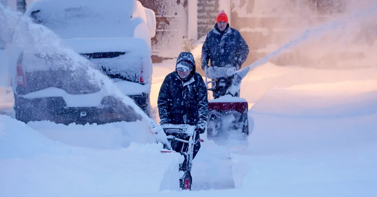
As Massachusetts residents dig out from the historic Blizzard of 2026 that dropped more than three feet of snow and triggered widespread travel bans, many are wondering how meteorologists predicted this massive storm and how officials make critical safety decisions. Understanding weather forecasting isn't just about checking your phone app—it's a complex science that combines technology, data analysis, and human expertise to protect communities from severe weather events.
The Science Behind Weather Predictions
Modern weather forecasting begins with an extensive observation network that includes weather stations, satellites, Doppler radar, weather balloons, and ocean buoys. According to the National Weather Service, forecasters first gather current atmospheric data, then create detailed analyses of conditions before using numerical models to predict future changes. "The forecast process is roughly the same regardless of the type of weather," explains the NWS. "Our scientists thoroughly review current observations using technology such as radar, satellite and data from an assortment of ground-based and airborne instruments to get a complete picture of current conditions."
Numerical modeling forms the backbone of modern forecasting, with supercomputers running complex equations that simulate atmospheric physics. However, different models sometimes produce conflicting predictions, requiring human forecasters to draw on their experience and local knowledge. One of the most critical aspects of forecasting is communicating uncertainty—letting the public know which parts of a forecast are less certain and what worst-case scenarios might look like.
Timeline: How the Blizzard of 2026 Unfolded
The storm that would become known as the Blizzard of 2026 began developing off the Atlantic coast in late February, with forecasters first identifying potential for a major nor'easter several days in advance. By February 23, the National Weather Service had issued blizzard warnings for eastern Massachusetts as computer models converged on predictions of historic snowfall. On February 24, the storm made landfall, bringing winds exceeding 60 miles per hour and snowfall rates of 2-3 inches per hour. By the storm's peak, some Massachusetts communities recorded snow totals exceeding 40 inches, with widespread power outages affecting hundreds of thousands of residents.
Understanding Nor'easters: Boston's Winter Storm Engine
The storm that hit Massachusetts was a classic nor'easter, a type of cyclone that frequently impacts the Northeast United States. Named for the northeasterly winds that accompany these systems, nor'easters typically develop between Georgia and New Jersey before moving northeastward along the coast. "A Nor'easter is a storm along the East Coast of North America, so called because the winds over the coastal area are typically from the northeast," states the National Weather Service. "These storms may occur at any time of year but are most frequent and most violent between September and April."
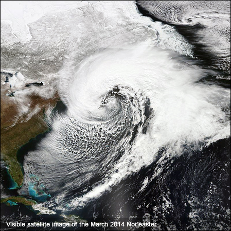
Nor'easters derive their energy from the temperature contrast between warm air over the Gulf Stream ocean current and cold Arctic air over land. This differential creates instability that fuels powerful storm development. The heavily populated corridor between Washington D.C., Philadelphia, New York, and Boston—often called the "I-95 Corridor"—is particularly vulnerable to nor'easter impacts, which can include heavy snow, rain, coastal flooding, and hurricane-force winds.
Travel Bans and Safety Decisions: How Officials Respond
As the Blizzard of 2026 intensified, Massachusetts Governor Maura Healey took the unprecedented step of issuing travel bans for three southeastern counties: Bristol, Plymouth, and Barnstable. These emergency orders prohibited non-essential motor vehicle travel to keep roads clear for emergency responders and snow removal crews. "This is a serious storm, and we need everyone to take it seriously," Healey stated during the emergency declaration.
Travel bans represent one of the most significant tools available to public officials during severe weather events. Decisions to implement such restrictions are based on multiple factors, including forecasted snowfall amounts, wind speeds, visibility conditions, and the anticipated impact on emergency services. The Massachusetts Emergency Management Agency works closely with the National Weather Service to determine when conditions warrant travel restrictions, balancing public safety against the economic and personal disruption caused by shutting down transportation networks.
What Happens Next: Preparing for Future Storms
As climate patterns evolve, meteorologists are studying how factors like ocean temperature changes might affect nor'easter frequency and intensity. For residents, understanding basic weather forecasting principles can improve preparedness for future storms. The National Weather Service recommends several key steps: monitor forecasts regularly from reliable sources, understand the difference between watches (conditions possible) and warnings (conditions imminent), and have an emergency kit ready with at least three days of supplies.
Technological advances continue to improve forecasting accuracy, with newer satellite systems, enhanced radar technology, and more sophisticated computer models providing earlier warnings of severe weather. However, the human element remains crucial—experienced forecasters who can interpret model output and communicate risks effectively to the public.
Key Takeaways: Weather Forecasting Essentials
Weather prediction has come a long way from simple observation to complex computer modeling, but the fundamental process remains grounded in scientific principles. Nor'easters like the Blizzard of 2026 demonstrate both the power of nature and the importance of accurate forecasting for public safety. Travel bans and other emergency measures, while disruptive, are carefully considered decisions based on the best available weather science. As forecasting technology continues to advance, the partnership between meteorologists, emergency managers, and the public will remain essential for weathering whatever storms New England's climate may bring in the future.